Table of Contents
- Why Geostationary Latency Was Unfixable
- The Trade Low Orbit Makes
- Coverage Requires a Constellation
- Handover Every Few Minutes
- The Ground Segment Constrains Everything
- Capacity Is Shared and Geographic
- Orbital Congestion Is a Real Constraint
- Where This Technology Fits
- Common Misconceptions
- Conclusion
- Frequently Asked Questions
Key takeaway: Low orbit reduces latency by roughly two orders of magnitude and requires thousands of satellites with five-year lifespans, continuous handover, extensive ground infrastructure, and orbital coordination that has no established governance.
Why Geostationary Latency Was Unfixable
Geostationary satellites orbit at approximately 35,786 kilometres, where orbital period matches Earth’s rotation so the satellite appears stationary. That property is enormously useful — a fixed antenna points at one spot in the sky permanently — and it comes with a latency floor set by physics.
The signal must travel up and back down: roughly 72,000 kilometres round trip. At light speed that is about 240 milliseconds, before any processing. Real-world round-trip times land around 600 milliseconds once ground network transit and equipment latency are included.
No engineering removes this. The distance is fixed by the orbital mechanics that make the satellite geostationary.
For television broadcast, one-way and latency-insensitive, this is irrelevant. For interactive use it is disqualifying. Video calls with 600 millisecond round trips are painful. Interactive applications feel broken. Online gaming is impossible. And protocols designed for terrestrial latency behave badly — connection establishment requiring several round trips takes seconds.
Low Earth orbit addresses this directly. At 550 kilometres, the round trip is roughly 1,100 kilometres, which is about 4 milliseconds of propagation. Real-world figures of 20 to 50 milliseconds are comparable to terrestrial broadband.
That is a genuine transformation in capability. Everything else in this article is a consequence of what it costs.
The Trade Low Orbit Makes
Lowering the orbit changes several properties simultaneously, and only one of them is favourable.
Latency falls dramatically. The reason for doing it.
Coverage per satellite collapses. A geostationary satellite sees roughly a third of Earth’s surface. A satellite at 550 kilometres sees a small fraction of that. Global coverage requires thousands rather than three.
Satellites move rapidly. At that altitude, orbital velocity is around 7.6 kilometres per second, completing an orbit in about 95 minutes. A given satellite is above any location for only minutes.
Antennas must track. A fixed dish cannot follow a fast-moving target. User terminals need phased-array antennas that steer electronically, which are considerably more expensive than a static dish.
Lifespan shortens. Residual atmospheric drag at that altitude decays orbits continuously. Satellites need propulsion to maintain altitude and deorbit within roughly five years. A geostationary satellite operates for fifteen or more.
Replacement is continuous. A constellation of several thousand satellites with five-year lives requires launching hundreds annually, permanently, simply to stand still.
That last consequence is the one that determines whether the business model works. This is not a system you build and operate — it is a system you continuously rebuild, and the launch cost is a permanent operating expense rather than a capital one.
Coverage Requires a Constellation
The geometry sets the minimum scale, and it is worth understanding why the numbers are so large.
A satellite at 550 kilometres has a service footprint of a few hundred kilometres radius, depending on the minimum elevation angle acceptable. Below roughly 25 degrees above the horizon, the signal passes through too much atmosphere and encounters too many obstructions.
For continuous coverage of a location, at least one satellite must always be within that footprint. Since satellites move, this requires enough satellites distributed across enough orbital planes that as one leaves, another arrives.
The arithmetic produces constellation sizes in the thousands for global coverage with capacity. And coverage is not uniform: satellites in inclined orbits spend more time over mid-latitudes than over the equator, so equatorial regions receive proportionally less coverage from the same constellation — which is the inverse of where population density is highest in some regions.
Polar coverage requires specific orbital inclinations, and high-latitude coverage is where these systems have their clearest advantage over both geostationary satellites, which see poles poorly, and terrestrial infrastructure, which is sparse there.
Handover Every Few Minutes
A satellite is usable from a given location for perhaps five to ten minutes. Then the connection must transfer to another satellite, without the user noticing.
This happens continuously, for every terminal, forever. The engineering requirements:
Predictive scheduling. The system knows orbital positions precisely and plans handovers in advance rather than reacting to signal loss.
Beam steering coordination. Both the satellite and the terminal must retarget, in synchronisation.
Session continuity. Connections must survive the transfer. A handover that resets connections would be visible in every application.
Capacity awareness. The incoming satellite must have capacity available, which means handover decisions are also load-balancing decisions.
Graceful degradation. Weather, obstructions, and unfavourable geometry mean the ideal satellite is sometimes unavailable.
The consequence for users is latency variation rather than latency magnitude. Average latency is good; the distribution has more variance than terrestrial fibre, because geometry changes continuously and handovers introduce brief perturbations. Applications sensitive to jitter rather than to absolute latency notice this.
Inter-satellite laser links change the picture where deployed. Satellites relaying between themselves can route traffic across the constellation without returning to the ground, which reduces dependence on ground station placement and enables service over oceans and regions without local infrastructure. This is a significant capability and it adds complexity — the constellation becomes a routing network in motion.
The Ground Segment Constrains Everything
The satellites receive attention; the ground infrastructure determines what the system can actually deliver.
Without inter-satellite links, every satellite must be simultaneously visible to both a user terminal and a ground station connected to terrestrial networks. That means ground stations must be distributed wherever service is offered, which is a substantial physical and regulatory undertaking.
The constraints:
Geographic distribution. Ground stations must be positioned so that satellites serving users can also reach one. Ocean and remote-area coverage is limited by this, absent inter-satellite links.
Terrestrial connectivity. Each station needs high-capacity fibre connection to the internet, which requires that fibre to exist where the station is.
Regulatory approval. Spectrum licensing and landing rights are granted per country. A constellation with global technical coverage cannot legally serve countries that have not authorised it, and this is frequently the binding constraint on market entry rather than technology.
Weather. Higher-frequency bands used for gateway links attenuate significantly in heavy rain. Site diversity — several stations in an area — mitigates this and multiplies infrastructure cost.
The regulatory point is worth emphasising because it is invisible in technical discussion. Spectrum coordination is managed internationally with national implementation, and obtaining authorisation is a multi-year process per jurisdiction. A constellation can be technically operational and commercially unavailable across large portions of the world.
Capacity Is Shared and Geographic
The property most misunderstood by users: satellite capacity is finite, shared, and geographically distributed in a way that does not match demand.
A satellite has fixed total throughput divided among the users in its footprint. Add users in one area and per-user capacity falls. This makes the system fundamentally different from terrestrial networks, where capacity is added by installing more equipment in the specific location that needs it.
The consequences:
Density limits. A dense urban area cannot be served by satellite at scale, because the satellites overhead cannot supply the aggregate demand. These systems are structurally suited to low-density areas.
Congestion is local and temporal. Performance varies by location and time of day as satellite footprints move across areas of differing demand.
Adding capacity means adding satellites. Which means launches, which is slow and expensive compared to installing a terrestrial node.
Oversubscription is unavoidable. Like all networks, and with less headroom and less ability to respond quickly to demand growth.
The structural conclusion is that satellite constellations complement terrestrial networks rather than competing with them. Their advantage is coverage where terrestrial infrastructure is uneconomical — sparse populations, oceans, aviation, remote industry. In dense areas, terrestrial infrastructure is both cheaper and higher capacity by a wide margin, and no constellation size changes that.
Orbital Congestion Is a Real Constraint
Placing thousands of satellites in a shell of space has consequences that extend beyond any single operator.
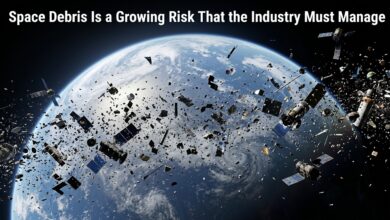
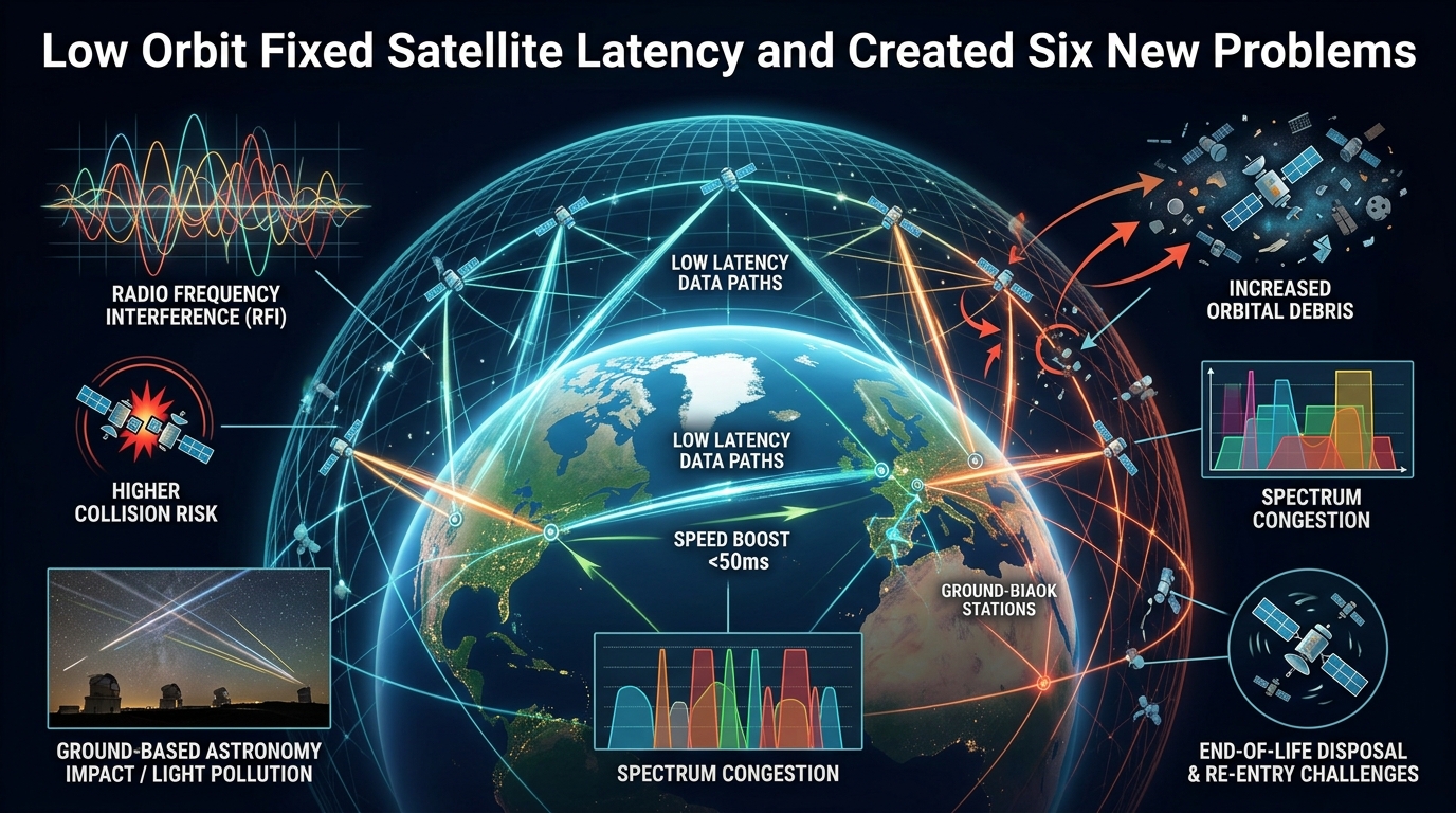
Collision risk. Objects at these altitudes travel at several kilometres per second. A collision produces thousands of fragments, each capable of causing further collisions. The concern is a cascade — the debris from collisions causing more collisions — which would render orbital shells unusable for a long period.
Conjunction management. Operators must track approaches and manoeuvre to avoid them. This requires accurate position data, propulsion capability, and coordination between operators. There is no binding international mechanism requiring coordination, which means it depends on voluntary cooperation.
Debris from failures. A satellite that fails before deorbiting remains in orbit for years, uncontrolled and unable to avoid anything.
Deorbit reliability. Designs intend controlled deorbit at end of life. Failures mean objects remain longer, and the reliability rate matters enormously when multiplied across thousands of satellites.
Astronomical interference. Satellite trails in telescope images and radio emissions affecting radio astronomy. Mitigation efforts exist and the impact on ground-based observation is real and documented.
Atmospheric effects of reentry. Thousands of satellites deorbiting annually deposit their material in the upper atmosphere. The consequences are being studied and are not yet well characterised.
The governance gap is the genuine concern. Orbital slots and spectrum are coordinated internationally; the physical use of orbital shells is not, in any binding way. Multiple operators deploying large constellations into overlapping altitudes with voluntary coordination is a situation without precedent and without an established mechanism for resolving conflicts.
Where This Technology Fits
The applications where satellite constellations are clearly superior:
Rural and remote connectivity where terrestrial deployment is uneconomical. The core case, and it is genuinely transformative for the populations affected.
Maritime. Ships have had only expensive, slow options. This is a substantial improvement.
Aviation. In-flight connectivity with usable latency.
Disaster response. Rapid deployment where terrestrial infrastructure is damaged or absent.
Remote industry. Mining, energy, agriculture, and research in locations without infrastructure.
Backhaul for remote cellular sites. Connecting a tower where fibre does not reach.
Where it does not fit: dense urban areas, where terrestrial capacity is far higher and cheaper. Applications requiring the lowest possible latency, where fibre remains better. And anywhere requiring guaranteed capacity, since shared satellite capacity varies.
The honest framing is that these systems address a specific and important gap — connectivity where laying cable does not pay — rather than replacing terrestrial networks. That gap affects a large number of people, which makes it valuable without making the technology universal.
Common Misconceptions
“Satellite internet will replace fibre.” Capacity per area is far lower and cost per bit far higher. It complements rather than replaces.
“More satellites means faster speeds.” More satellites means more total capacity and more coverage. Per-user speed depends on how many users share a footprint.
“Latency is now the same as fibre.” Comparable in magnitude, with more variance from continuous geometry changes and handovers.
“Global coverage means global service.” Regulatory authorisation is per country and frequently the binding constraint on availability.
“Satellites deorbit safely and automatically.” Designs intend it; failures leave objects in orbit uncontrolled for years.
“Space is too big for congestion to matter.” Useful orbital shells are thin, and collision cascades are a documented risk rather than a hypothetical one.
Conclusion
Low Earth orbit solved the latency problem that made satellite internet unsuitable for interactive use, reducing round trips from roughly 600 milliseconds to a range comparable with terrestrial broadband. That is a real and significant achievement.
The cost is that everything else becomes harder. Coverage per satellite collapses, so thousands are needed. Orbits decay, so satellites last about five years and must be continuously replaced — making launch a permanent operating cost. Users need steerable antennas. Connections hand over every few minutes. Ground stations must be distributed and individually authorised per country, which is frequently the actual constraint on service availability.
And capacity is shared within a moving footprint, which means these systems are structurally suited to low-density areas and cannot serve dense ones at scale regardless of constellation size.
The unresolved question is orbital governance. Thousands of satellites from multiple operators in overlapping altitudes, coordinated voluntarily, with collision cascade as the failure mode. That is a genuine collective risk with no binding mechanism for managing it, and it is the part of this story that most warrants attention.
Frequently Asked Questions
Why is low-orbit latency so much better? Distance. A geostationary satellite is about 36,000 km away, giving roughly 240 ms of propagation before processing. At 550 km the propagation is a few milliseconds.
Why do so many satellites need launching continuously? Atmospheric drag decays low orbits, limiting satellite life to roughly five years. A constellation of thousands therefore requires hundreds of replacement launches annually just to maintain size.
Can satellite internet serve cities? Not at scale. Capacity is shared within a satellite footprint covering a large area, so dense demand exceeds what the satellites overhead can supply. Terrestrial infrastructure is both cheaper and higher capacity there.
What do inter-satellite laser links change? They let traffic route across the constellation without returning to the ground, enabling service over oceans and regions lacking ground station infrastructure, and reducing dependence on ground station placement.
How serious is the collision risk? Genuine and actively managed. The concern is a cascade where collision debris causes further collisions, potentially rendering an orbital shell unusable. Voluntary coordination is currently the primary mitigation.
Why is service unavailable in some countries with technical coverage? Spectrum licensing and landing rights are granted nationally. Authorisation is a multi-year regulatory process per jurisdiction, independent of technical capability.
Does weather affect the connection? Yes. Higher-frequency bands attenuate in heavy rain, affecting both user links and ground station links. Site diversity mitigates the ground segment; user terminals experience degradation during severe weather.